New York map poster — free & printable
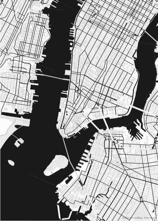
Manhattan above Houston Street is the most disciplined piece of urban geometry anywhere — the 1811 Commissioners' Plan laid twelve avenues and 155 cross streets over farmland and hills without apology. Below Houston the grid dissolves into the colonial tangle of the original Dutch settlement. A poster that includes both gets a visible seam between two cities.
United States · centred near 40.7484° N, 73.9857° W
Broadway is the flaw that makes the pattern
Broadway follows an old Lenape trail, so it runs diagonally across a grid that was designed to ignore it. Every place the diagonal crosses an avenue it opens a wedge of leftover space — Times Square, Herald Square, Madison Square, Union Square. On a map those wedges appear as small irregular interruptions in an otherwise mechanical field, and they are the single most useful thing to compose around.
Central Park is a hole, not a feature
Eight hundred and forty-three acres of the grid simply missing. In most palettes the park renders as one large flat block, which means it dominates whatever crop it appears in. Put it centre-frame and the poster becomes a poster of the park; push it to the upper third and the grid stays the subject with the park as a counterweight. Either works, but it is a decision rather than an accident.
Water on three sides
The Hudson, the East River and the Harlem River make Manhattan an island with an unusually recognisable silhouette. Zoom out to around 11.5 and the whole island fits a portrait frame with room for Brooklyn and Queens either side — which is the crop most people picture when they think of a New York map, and the reason portrait is almost always the right orientation here.
Where to centre a New York poster
- Midtown
- The densest part of the grid, where the avenue labels and the Broadway wedges are all in one frame.
- Lower Manhattan
- Colonial streets with no grid at all — the strongest contrast available on a New York poster.
- Williamsburg
- Brooklyn's own grid, rotated off Manhattan's axis, with the waterfront and the bridge approach.
- Harlem
- Where the Manhattan grid meets the Harlem River and starts to skew.
- Brooklyn Heights
- Puts the East River, the bridges and both boroughs' street patterns in a single crop.
- Long Island City
- Looks back across the river, so Manhattan's skyline edge becomes the far bank.
Why Midnight suits New York
Midnight inverts the usual relationship: the ground goes dark and the streets are drawn as light lines, so the grid reads like an illuminated circuit. It is the only palette here where New York's regularity becomes the point rather than a background texture. Black is the more extreme version of the same idea; Plotter is the right pick if you want the grid to read as a technical drawing instead.
Printing and framing New York
Manhattan is roughly four times taller than it is wide, so portrait is close to mandatory — 18 × 24" or A2 both hold the whole island comfortably. If you want Brooklyn and Queens at real detail as well, go square and accept losing the northern tip, or go up to 24 × 36" and keep everything.
Every export is drawn at your chosen paper size rather than upscaled from a screenshot. See the full printing guide for sizes, DPI, bleed and crop marks.
New York map poster questions
Can I get the whole of Manhattan on one poster?
Yes, at around zoom 11.5 in a portrait frame. The island fits from Battery Park to Inwood with the Hudson and East River on either side. Street names stop rendering at that scale, so if you want legible labels make the poster of a smaller area instead.
How do I make a poster of one specific New York neighbourhood?
Search the neighbourhood by name and zoom to 14 or 15. At that level the cross streets and avenues are labelled individually, which is what makes an apartment-block or first-home print work. Lower Manhattan and Brooklyn reward this more than Midtown, because their street patterns are less repetitive.
Does the map include the five boroughs or just Manhattan?
Whatever you frame. The underlying data covers all five, so you can centre on Staten Island or the Bronx as easily as on Midtown. Fitting all five at once needs a square or landscape crop at roughly zoom 10.